





Stavy a průtoky vodních toků

Description of Stavy a průtoky vodních toků
আপনি কি রাজ্য (স্তর) এবং জলচক্রের প্রবাহ সম্পর্কে তথ্য সম্পর্কে আগ্রহী?
আপনি কি এখনও পৃথক নদী অববাহিকার পৃষ্ঠাগুলির স্থিতি এবং প্রবাহ সম্পর্কিত তথ্য সন্ধান করতে ক্লান্ত?
যখন নির্বাচিত জলের প্রবাহের স্তরটি আপনার নির্ধারিত সীমাটির ওপরে উঠে যায়, তখন কি এটি জানাতে হবে?
আপনি কি একজন প্যাডেলার এবং আপনি কোনও জনপ্রিয় স্ট্রিমের উত্তরণে আগ্রহী?
অ্যাপ্লিকেশন স্টেটস এবং ওয়াটারকোর্সগুলির প্রবাহ চেক এবং স্লোভাক রিপাবলিকগুলির জুড়ে ওয়াটারকোর্সে জলের অবস্থান এবং প্রবাহ সম্পর্কে তথ্য সরবরাহ করে। প্যাডেলারদের জন্য এটি স্ট্রিমগুলির নাব্যতা সম্পর্কেও তথ্য সরবরাহ করে।
তথ্য ব্যবহার করে:
1) পৃথক নদীর অববাহিকার পৃষ্ঠা থেকে:
»ওহে নদী অববাহিকা
»ভ্লতাভা অববাহিকা
El এলবে অববাহিকা
»মোরাভা নদীর অববাহিকা
। ওড্রা নদীর অববাহিকা
2) চেক হাইড্রোমিটরিওলজিক ইনস্টিটিউটের ওয়েবসাইট থেকে - সিএইচএমআই। এই ক্ষেত্রে, ডেটা CHMI শাখা অনুসারে বাছাই করা হয়:
»সিএইচএমআই ব্র্নো
»CHMI éeské বুদোজোভাইস ice
»সিএইচএমআই হারাদেক ক্রোলোভ é
»সিএইচএমআই অস্ট্রভ
»সিএইচএমআই পিলসেন
»সিএইচএমআই প্রাগ
»CHMI ÚstÚ nad Labem
3) ছোট জলছবিগুলির বন্যার সিস্টেমের পৃষ্ঠা থেকে:
»ডিভিটি সেসো (পৌরসভা উত্তর বোহেমিয়ান সমিতি)
»ডিভিটি পিলসেন
»ডিভিটি হারানিস
»ডিভিটি বাইস্টাইস
»ডিভিটি ইস্টার ডিম
»ডিভিটি কেআরকেভি (কার্লোভী ভেরি অঞ্চল)
»ডিভিটি টোবার
»ডিভিটি ল্যানাক্রাউন
»ডিভিটি Říč
4) Hladiny.cz ওয়েবসাইট থেকে:
Towns শহর ও পৌরসভা কেন্দ্র (এলভিএস)
5) ভিওএক্স সতর্কতা সিস্টেম ওয়েবসাইট থেকে:
O ভক্স - স্তর
)) এসকে নদীর অববাহিকার পৃষ্ঠা থেকে:
»ওজেড ব্র্যাটিস্লাভা
»ওজেড পাইনি
»ওজেড বাঁশকা বাইস্ট্রিকা
»ওজেড কোয়েসিস
)) স্লোভাক হাইড্রোমিটোরোলজিক ইনস্টিটিউটের ওয়েবসাইট থেকে - এসএমএম:
»SHMÚ ব্র্যাটিস্লাভা অঞ্চল
»SHMÚ ইলিনা অঞ্চল
»SHMÚ বাঁশকোবাইস্ট্রিক অঞ্চল
»SHMÚ কোয়েস অঞ্চল
অ্যাপ্লিকেশন ফাংশন:
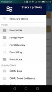
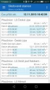
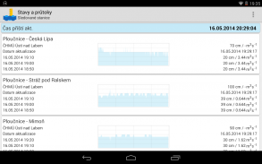
Individual স্বতন্ত্র উত্সের জলকোষগুলির তালিকা প্রদর্শন করা
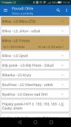
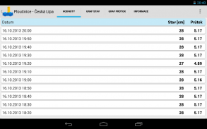
Individual পৃথক স্ট্রিমগুলিতে স্তর এবং প্রবাহ সম্পর্কে বর্তমান তথ্য (বন্যার ক্রিয়াকলাপের ডিগ্রি অনুসারে গ্রাফিকালি হাইলাইট করা হয়েছে)
Flow জলের প্রবাহ সম্পর্কে বুনিয়াদি তথ্য (বন্যার ক্রিয়াকলাপের স্তর)
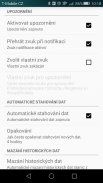
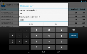
Selected যদি নির্বাচিত ওয়াটারকোর্সগুলিতে পর্যবেক্ষণকৃত রাজ্য (স্তর) বা প্রবাহকে ছাড়িয়ে যায় তবে একটি সতর্কতার প্রদর্শন করুন
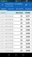
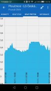
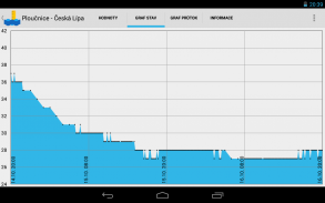
State রাজ্য বিকাশের প্রদর্শন গ্রাফ (স্তর)
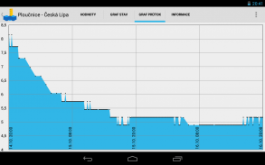
Flow প্রবাহ বিকাশ প্রদর্শনের গ্রাফ
Selected নির্বাচিত দেখা স্টেশনগুলির উইজেট
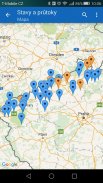
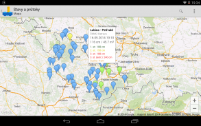
All মানচিত্রের সমস্ত স্টেশন, পর্যবেক্ষণ স্টেশন বা একটি নির্দিষ্ট স্টেশন দেখুন
The মানচিত্রে স্টেশনটির অবস্থান সম্পাদনা করুন
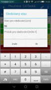
Ig নেভিগিবিলিটি তথ্য প্রদর্শন এবং সম্পাদনা করুন (প্যাডেলারদের জন্য)
নতুন সংস্করণ পরীক্ষা করা:
আপনারা কেউ যদি নতুন সংস্করণ (বিটা) এর পরীক্ষায় অংশ নিতে চান তবে আপনাকে এখানে পরীক্ষক হিসাবে লগ ইন করতে ক্লিক করতে হবে: https://play.google.com/apps/testing/cz.astran.stavyaprutoky
এখন আপনাকে গুগল প্লেতে অ্যাপ্লিকেশনটির বিটা সংস্করণে আপডেটগুলি দেওয়া হবে।
প্রয়োজনীয় অনুমতিগুলির যথার্থতা (অ্যাপ্লিকেশনটি ব্যবহারকারীর ডেটা ক্ষতি করার জন্য অনুমতিগুলি ব্যবহার করে না, এটি প্রয়োজনীয় সমস্ত অনুমতিও ব্যবহার করে এবং এটি সঠিকভাবে কাজ করার জন্য প্রয়োজন):
SD এসডি কার্ডের সামগ্রী পড়ুন / এসডি কার্ডের সামগ্রী সম্পাদনা করুন বা মুছুন
এই অনুমতিটির জন্য গুগল মানচিত্রের ব্যবহার প্রয়োজন, যা অ্যাপ্লিকেশন স্টেশনগুলি প্রদর্শনের জন্য ব্যবহার করে - সম্ভবত মানচিত্রের ফাইলগুলি ক্যাশে করা হচ্ছে।
Google গুগল পরিষেবা কনফিগারেশন পড়ুন
এই অনুমতিটির জন্য গুগল মানচিত্রের ব্যবহার প্রয়োজন, যা অ্যাপ্লিকেশন স্টেশনগুলি প্রদর্শনের জন্য ব্যবহার করে।
Your আপনার ডিভাইসে অ্যাকাউন্টগুলি অনুসন্ধান করুন
অ্যাপ্লিকেশন আপনাকে মানচিত্রে মাপার স্টেশনগুলির অবস্থানগুলি সম্পাদনা করার অনুমতি দেয়। তবে আমাদের মধ্যে এমন অনেকে আছেন যারা ইচ্ছাকৃতভাবে ডেটা ক্ষতি করতে চান। অতএব, যদি অননুমোদিত ("ভুল") স্থানাঙ্ক পরিবর্তন হয় তবে নির্দিষ্ট অ্যাকাউন্টের জন্য এই বৈশিষ্ট্যটি অক্ষম করা সম্ভব।
তদতিরিক্ত, আবেদনে কোনও অবদানের ক্ষেত্রে বিজ্ঞাপনটি সরাতে অনুমতি ব্যবহার করা হয়।
»সম্পূর্ণ নেটওয়ার্ক অ্যাক্সেস
এই অনুমতি ব্যতীত অ্যাপ্লিকেশনটির জন্য কোনও ডেটা ডাউনলোড করা সম্ভব হবে না - সুতরাং এটি আসলে কাজ করবে না।
Start শুরুতে শুরু করুন
কেবলমাত্র যদি আপনি দেখানো স্টেশনগুলির স্বয়ংক্রিয় আপডেটগুলি সেট আপ করেন তবে প্রয়োজন। সিস্টেম প্রারম্ভকালে, অ্যাপ্লিকেশনটি সিস্টেম টাইমারটিতে আপডেটের সময়টি সংরক্ষণ করে এবং বন্ধ হয়ে যায়।
অ্যাপ্লিকেশন থেকে ডেটা প্রেরণ:
অ্যাপ্লিকেশনটি নিরাপদে কিছু সংবেদনশীল ডেটা (ডিভাইস আইডি এবং ডিভাইস অ্যাকাউন্টের নাম) অ্যাপ্লিকেশন সার্ভারে https: avy stavyaprutoky.cz ব্যবহারকারীর অনুমতি পরে প্রেরণ করে।
এই উপায়ে সরবরাহ করা ডেটা কেবল অ্যাপ্লিকেশন থেকে বিজ্ঞাপনটি সরিয়ে ফেলার সম্ভাবনা বা অনিয়ন্ত্রিত ব্যবহারকারীদের জন্য অ্যাপ্লিকেশনটিতে স্টেশনগুলি সম্পাদনার সম্ভাবনা সীমিত করার জন্য ব্যবহার করা হয়।
প্রেরিত ডেটা কেবলমাত্র অ্যাপ্লিকেশনগুলির প্রয়োজনের জন্য ব্যবহৃত হয় এবং তৃতীয় পক্ষগুলিকে সরবরাহ করা হয় না।


